
Thorough 3D measured building surveys to de-risk your next construction or renovation project
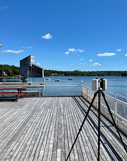
Laser scanning is ideal for capturing your construction or renovation projects in 3D space with speed and detail and can be referenced within common 3D modeling and coordination software used by building design and construction professionals. With technology evolving at an ever-staggering pace and new products entering the market at affordable prices, new users at organizations with a diverse range of skills are starting to add 3D data capture to their toolset. So, why SDMM?
Working with the SDMM reality capture team has been an absolute pleasure. They brought an informed and practical approach to a difficult problem and made it reality, at least in the digital reality world. They listened to what the problem was, offered varying levels of solutions to both the design team as well as for the Owner, and then worked together with our design team to provide a solution.
The SDMM reality capture team completed a 3D laser scanning survey and converted their digital point cloud information to a workable Revit model that the design team could review and incorporate into their design to provide the final solution. Without SDMM as part of the team, I don’t think we would have been able to provide the high level of service and solutions that we were expected to deliver to our client.” – Manager, Structural Engineering, CBCL
What Are 3D Laser Scanning Benefits
Many factors impact the quality of a survey and not all point clouds are created equally. Laser scanning is a core competency of our company. We combine formal training, project experience, and decades of survey best practices with state-of-the-art hardware/software tools to create high-quality deliverables free from errors.
We approach every project from a position of accountability and, when it has to be right, it’s our proficiency in surveying, project management and delivery, and professional staff that sets us apart.
Experience the advantages of using detailed, 3d measured data created by laser scanning systems providing much greater context compared to tradition survey deliverables. Our customers use our services for many design or as-built applications including:
- Scan to CAD – scanning existing buildings to create as-built floor plans and elevations drawings
- Scan to BIM – scanning existing assets to create a digital twin or as-built 3D model
- Engineering applications including highly detailed mechanical and structural design
- Architectural and heritage surveys
- Rail and road corridor feature surveys
- Condition assessment reporting
- Clash detection and conformance
- Floor flatness (FFL/FFE)
- Utilities, powerlines, and street furniture mapping
- Volumetric surveys
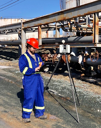
Industrial 3D Laser Scanning
Our 3D laser scanning service captures highly detailed measurements for industrial sites, ensuring accurate documentation of equipment layouts, structural elements, and facility infrastructure. This precise data streamlines modifications, safety assessments, and maintenance plans.

Point Clouds
We create precise 3D point clouds that represent the intricate details of your site or building. These dense data sets provide a reliable foundation for accurate modeling, virtual inspections, and clash detection, supporting seamless project coordination.
As-Built Measuring Services
As-builts are detailed drawings or plans that show the existing condition of a building or site. As-builts offer an accurate snapshot of the current state of a structure, capturing architectural, structural, utility, and MEP system dimensions, as well as locations and material specifications. This precise information supports smoother collaboration between architects, engineers, and contractors, ultimately saving time and reducing costs during project planning and execution.

Floor Plans and Elevations Drawings
Our service delivers accurate floor plans and elevation drawings based on laser-scanned data. These deliverables reflect the exact dimensions and layout of your building, aiding in planning, renovation, and regulatory compliance.
Digital Twin Laser Scanning
We offer digital twin laser scanning, creating a virtual replica of your physical space. This 3D model allows for real-time remote access and analysis, improving decision-making and collaboration across project stakeholders.
Heritage Surveys in Halifax
Preserve Nova Scotia’s rich history with our specialized heritage surveys. Using 3D laser scanning technology, we can capture detailed measurements of historical buildings and cultural sites, providing essential resources for restoration and preservation efforts.

Learn More About 3D Scanning
Learn more about 3D laser scanning innovations and practical applications of this cutting-edge technology. Whether you’re in architecture, engineering, or construction, our 3D laser scanning solutions enhance project accuracy, efficiency, and safety. Stay informed on best practices, industry trends, and innovative solutions for streamlining your workflows. Discover how 3D laser scanning is revolutionizing site assessments, clash detection, and design-build processes, making it an indispensable tool for modern projects. For more detailed information, refer to our FAQs about reality capture.