
Cloudworx Viewer for Revit: Streamline Your Reality Capture Workflow
Laser Scanning Data Liberation!
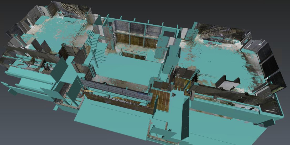
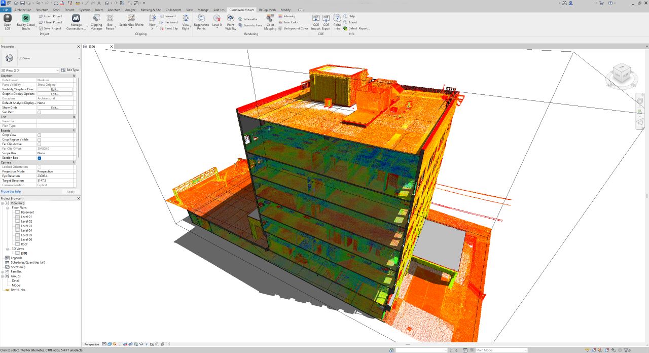
We are excited to share that Leica Geosystems has released a FREE plugin for Revit - Cloudworx Viewer for Revit. This means our customers who use Revit and get their existing condition surveys from us can now shed the burden of downloading and managing large point cloud data sets.
Stream Reality Data Directly Into Revit
Many of our clients already enjoy 24/7 virtual site inspections by streaming our 3d reality data and imagery on their phones or computers using our Reality Cloud Studio service. Now, by simply installing the free plugin, they get to:
Stream our surveys from Reality Cloud Studio straight into Revit without handling large local files.
Benefit from a high-performing toolset that allows them to:
- Visually inspect our point clouds vs existing models.
- Clip out areas of interest.
- Isolate classification categories relevant to their projects.
This pairing of the new Cloudworx Viewer for Revit with Reality Cloud Studio allows you to get our reality data quickly and efficiently. Updating project stakeholders and sharing data with distributed, complex teams has never been easier.
If you would like to take advantage of this simple and powerful new workflow, reach out to us, and we will get you up and running in no time!
What You Gain From This Reality Capture Workflow
- Faster Project Turnarounds: eliminate delays caused by transferring and managing large data files.
- Improved Team Collaboration: share accurate site data with architects, engineers, and contractors anywhere in the world.
- Reduced IT Burden: no need for high-spec workstations or massive storage for point clouds.
- Enhanced Project Accuracy: inspect, clip, and analyze site data directly in Revit for better design decisions.
Real-World Examples
- Design Development. Architects and Engineers can stream 3D scans directly into Revit to plan retrofits without ever visiting the site.
- Build Coordination and Verification. Construction teams can stream existing conditions into their coordination models to monitor and validate build progress and detect errors, omissions, and clashes in near real-time.
- Infrastructure Projects. Engineers can isolate structural components from the point cloud and analyze structural conditions remotely.
Ready to Get Started?
If you would like to take advantage of this simple and powerful new workflow, reach out to us and we will get you up and running in no time!